Translate

Friday 29 January 2016

Gertrude blows in, and out......January 29th. (Northumberland)
  When I was in the third year of school (Year 9 in modern parlance) Miss Buck, great English teacher and cricket lover, produced Hamlet for the annual play. The part of Gertrude was taken by a beautiful sixth form girl and we boys fairly drooled and I decided Hamlet was possibly the bard's greatest work. (I do remember the young lady's name but just in case she reads this, doubtful though that is, I will spare her blushes).
 This, as usual, has very little to do with today's gadgie outing except that the latest storm to hit the British Isles has been named Gertrude. It is the remnant of the storm that covered the east coast of the USA in snow but by the time it got here, warmed over the Atlantic, it brought rain, sadly much of it in Cumbria. She was, like a lot of very little girls (and boys) wet and windy.
Seven gadgies are braving Gertrude's gusts; Dave, Harry, Brian, John  C., John H., Ben and me* and we met in Tomlinsons cafe and bunkhouse in Rothbury for tea/coffee/teacake/scone/bacon sandwich. I have recently discovered that Americano means black coffee; why?
The whole walk is covered by OS OL 42 Kielder Forest and Water. Regular readers will know how to get to Rothbury but for new ones, from Newcastle take A1 north, A697 at Morpeth and follow the diversion signs for Rothbury. Tomlinsons is on bridge street, near the bridge.
We left the cars in the street and having booted up and put on waterproofs we set off.
                                                     Tomlinsons, Rothbury.
 Take the road down towards the bridge but turn right on the footpath, walking on the north side of the Coquet. This part is a well made path, popular with dog walkers. At the sign that says "If you need to cross this field do it in 9 seconds as the bull takes 10"  cross the stile and take a short cut over a bull free field to the footbridge over the river. Follow the markers across several muddy fields  before coming to a road. Turn right towards Newtown but then turn left and head for Great Tosson. gadgie Ben has a soft spot for this place and somewhere in the area is a whiskey still (legal) that has been operating over a year. The spirit will be marketed in a few years I'm told. The ruins of Tosson Tower are on the left.
Tosson Tower, a mere 600 years old. Built as protection against the Scots.
         
                               
There is also a lovely view across the Coquet Valley, bit hazy today, thanks Gertrude.
Walk west and just beyond the farm take the footpath on the left that leads up the appropriately named Windy Crag. This was the first time we came across the strength of Gertrude. Walking uphill into a gale was hard work,  I was not the only one who occasionally lost footing because of the wind. On a finer day and with more time, there is a fort on Burgh Hill to look at. At the top of Windy Crag the footpath goes alongside a plantation as it crosses several fields. One gate has an unusual mechanism.
The weight of the stone pulls the string which moves the wooden bar which closes the gate.

Enter the plantation (the style is well marked) and follow the footpath through the trees, cross one forest track and head uphill until you emerge on another track. Turn right.


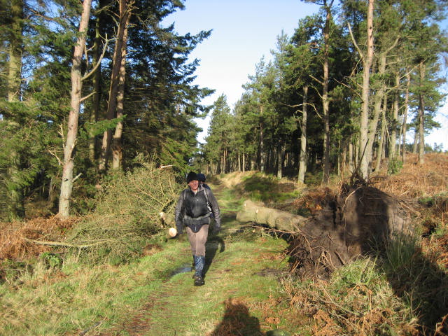
  One of Gertrude's victims. Missed me this time! (The weighted gate is on the left edge of the picture)
                  The end of the plantation bit. Much of it has been cut down, if it's replaced it should be with native deciduous trees.
A few hundred yards up the trail find the "Welcome to Simonside " noticeboard on the left.
It warns visitors about the Duergars of Simonside, nasty little dwarf like creatures who abduct innocent walkers and take them away, never to be seen again.
  The board is at the foot of a recently completed "stairway" that takes you up onto the ridge at Bob Pyle's Studdie. Bob was a particularly vicious PE teacher who made the lives of non sporting pupils misery through his mockery and sarcasm. A bit like my music teacher.
 The stairway has made the ascent much easier, previously there were several loose stretches. Purists may not like it but this is a popular walking area and has suffered from erosion.
                       The stairway at Bob Pyle's Studdie, one of the less steep sections.
Once on the ridge we were struck by the full force of Gertrude blowing in from the south west and making walking difficult. Those of us with walking poles found them very useful as we struggled on to Old Stell Crag where we called a Herbie Spot, sheltering in the rocks. ( A stell is a sheepfold, perhaps this was once used as a natural one.
Today's exchange included fudge, Hobnobs, seeded biscuits from Mrs A and flapjacks. We need the energy to battle Gertrude.
                                          Old Stell Herbie Spot.
Break over it was back on your heads as they say, as we struggled on in an easterly direction along the ridge. Some of the locals decorate a Christmas tree on the ridge, there were a couple of glittering streamers left, Gertrude had the lot.
At the end of the ridge  the path joins St. Oswald's Way (again!!!!) and heads downhill, out of the wind, across a road and through a car park. There are many examples of cup and ring markings in this area, a fort and a settlement but not today, Gertrude drove us on. The footpath is well marked and heads north across fields until it joins the Hillhead Road. Turn right and follow the road past Sharpe's Folly. Built by the Rev Sharp in the 1720s to provide work for local masons it's hard to miss at Whitton.
                                                  Sharp's Folly
Follow the road downhill and at the junction near the Whitton Towers turn right and walk down to the car park by the river.


                                             River Coquet, still full
Cross the river by the footbridge, turn right walk along the river bank and take the stairs on the left which bring you out at the Church.

All Saints, Rothbury, dates to 14th century but mostly Victorian
  Turn right and you are back to Tomlinsons. Debooted we headed for the Anglers Arms at Weldon Bridge which had Tim othy Taylor's Golden Bitter, Bombardier, Blacksheep and the usual warm welcome from the staff who thought we might well be nuts going on Simonside on such a windy day, but we are gadgies.
 THE MATRIX  MMXVI  D
                                                                 steps                                miles
NAK                                                      24307                                10.74
Dave's LIDL 3D                                    21716                                10.71
 "LIDL USB                                          19526                                8.93
 " NAK                                                  19283                                8.82
etrex                                                                                                8.5
Ben                                                                                                  8.5
John C                                                                                             8.7


Contains OS data, copyright. Crown copyright and databaseright 2016
* Ray has been awarded "wimp of the week "for not turning out because of the weather

Sunday 24 January 2016

As gadgies went down to the river to play.............. (Northumberland)
It is the Annual General Meeting held in the Anglers Arms, Weldon Bridge, Northumberland. But first a walk.
There is an octet of gadgies out today: John H., John Ha., Brian, Ray, Ben, Harry, Dave and me. Three cars are needed as will be explained later and we met in the car park of the Anglers Arms at Weldon Bridge, the reason will be obvious later also. To get to this wonderful hostelry take the A1 north and turn off onto the A697, continuing until you spot the sign for Anglers Arms.
Leaving our cars there we caught the X14 bus for Thropton (operated by Arriva) by standing on the roadside and waving it down, there not being a bus stop. We got off the bus at Rothbury but as it was raining decided to take shelter in Tomlinsons cafe and bunkhouse for tea, coffee, scones or bacon sandwiches, all good.
              Well worth a visit, good food, good drink and colouring in books for the middle classes.
The walk, which requires OS Explorer 325 Morpeth and Blyth.

Leaving the cafe we crossed the bridge and turned left, walking along the road past a small industrial estate until we spotted the sign directing us along St. Oswald's Way. (Again!)
                  The River Coquet from the bridge in Rothbury, fairly full after all the recent rain.
The most interesting section of this part of the walk is the graveyard for old tractors.

                                           Once some farmer's pride and joy.
Along Mill Lane there is a choice of paths; go down to the river and scramble through very muddy woods or follow the dismantled railway, 
                             Following the railway is prettier.
At some point the official route leaves the railway but being non readers we continued on the drier route until we came to an old railway cottage converted to a bungalow and a notice saying "Private No Access", but only visible once you had passed it. From here we followed a footpath that took us south of West Raw where we rejoined St. Oswald. 


  At this point, near West Raw it rained again. As Dave wonders what to do Brian solves the problem.
                     In the same area we came across a moleskin trouser factory. (It's done to show the mole catcher has done his job, and also serves as a deterrent to passing moles)
       The footpath went down towards the river  but when we came to the road we turned right, headed uphill for a short distance before crossing a footbridge,walking through soggy woods and soggy fields until we came to Thornyhaugh, where we called a Herbie Spot. Today's treats surpassed expectations; Czech Chocolate Christmas Tree Decorations, oat biscuits, chocolate covered biscuits from Mrs A., Almond slices, chocolate cake, ginger biscuits, and a cheese sandwich.
                           Holiday cottages at Thornyhaugh
                     Picnic table at Thornyhaugh; The lady of the house came out and asked if we needed tea or coffee. I felt a bit guilty declining but we all had flasks. 
Leaving the Herbie Spot we continued in the footsteps of St. Oswald across fields to Middleheugh and then uphill to walk above the river as it flowed past Brinkburn Priory. This 12 century Augustinian priory was a ruin, probably knocked about by the Scots too, but has been  completely restored and is run by  English Heritage and does weddings.

                                       Brinkburn Priory
                        and as seen fro the walk.
 Beyond the priory the footpath crosses more fields, including one that seemed to specialise in the production of turf. It had some unusual looking tractors.
                                        Turf cutter.
   Near the end of the walk the path descended to the river which was swollen after recent rains, before finally approaching home from home for the night, the Anglers Arms.
                                                             The Coquet at Weldon Bridge


                                            The Anglers Arms at dusk, not Dawn
                           The old mill at Weldon Bridge
   All eight of us entered the hostelry which Directors, Taylors and Bombardier on offer, all good ales and all welcome. After a couple of pints, but not for the driver, those not attending the AGM went off home.

The Matrix MMXVI    C
                                                                               steps                        miles
NAK                                                                      20325                       8.66
LIDL3D                                                                18509                       7.1
Dave's LIDL3D                                                    16637                       7.67
"              USB                                                       15720                      7.19
 "              NAK                                                     16816                       7.13
GPS                                                                                                        7.4

Contains OS data copyright. Crown copyright and Database right 2016.
I have added some photographs taken by Harry on the walk. They are exceptional.


                            Winter scenes in Coquetdale., Northumberland. All by Harry Nagel
The AGM.
  A journalist for the Northern Echo (I think) commented on our blog in his paper, describing us as a group of bus pass ramblers who had adventures and shared  jokes. He added that we had an annual  general meeting which consisted of drinking, eating and more drinking. He was right.
  The four of us who were left in the pub after the walk retired to our rooms to shower and snooze before reconvening in the dining area at 7.30pm for dinner.
Having rushed through the business of the meeting in a nano second we got down to the serious side. From the menu I chose the blackpudding, potato and egg starter. But it is so large we ended up sharing two between three of us, Ray choosing soup. For a main course I opted for fish and chips. The waitress placed it before me and said "Good luck". For once in my life I could not finish a meal it was such a large portion. I was pleased to see John H had to leave some too.

 Washed down with more Taylors and finished with a wee dram, the meeting came to a close about 11pm as the bar shut and we went off to bed.
In the morning we all managed to put away a delicious full English breakfast and several pots of tea or coffee.
After breakfast we drove to Rothbury for the second walk of the weekend.

  There is a small bus company called "Spiritbus" that runs several buses a day in the Coquet Valley and then off to Alnwick by way of Edlingham. It advertises itself as being in part a bus for walkers and it deserves support.(www.spiritbuses.co.uk) From Rothbury we took the bus round the valley through Netherwitton and Alwinton, passing the assembling Coquet Hunt on the way, complete with men in pink, until we got off at Hepple. The driver was friendly and helpful, waved to most people on the roadside as we passed, and pointed out how the river had changed course after the recent rains. The scenery was beautiful, worth the forty minute ride. The company deserves as many walkers as can climb aboard and of course support from the locals who use it too.

We walked from Hepple to Rothbury. If you don't use the bus you need at least two cars, it's a linear walk coverd by two maps OS OL 42 Kielder Water and Forest and OS OL 16 The Cheviot Hills and Hepple is at GR 983006.
                                     Starting point for today, not a car park
                                                Hepple from across the river near Bickerton
Leaving Hepple we walked south west before crossing the river Coquet. Almost immediately we followed the sign on the left that cut across a field to rejoin the road to Bickerton. There is a junction, right goes to Hepplewhite Field, but keep left and stay on the road to Bickerton.
Just beyond Bickerton on the left a signpost directed us to the ponds at Caistron. Once gravel pits these ponds are now a nature reserve of sorts with several hides but few birds on the water, apart from a large family of swans and an even larger family of coots. We made use of hide number 8 for a morning coffee. The hide was dedicated to Billy Gibson and had been, thanks to a broken window, the home for several swallow families. Break over we continued walking alongside the ponds before crossing several fields to Ryehill.
                             One of the hides at Caistron ponds
                                                 And the swans.
At Ryehill the path (signed) goes across several fields before reaching the river almost opposite Thropton where it turns south east but still alongside the river.


                                                    Come in number 125, your time's up
 Several fields later the path crosses the Coquet by a footbridge. Once on the north bank there is a choice, use the well made footpath that leads back to Rothbury or cross  a field that is only a short cut. Take notice of the notice as you rejoin the well made path. "You need to cross this field in 9 seconds as the bull takes 10"
 Once on the footpath we were soon back in Rothbury, crossed the bridge to the car park and, having removed very muddy boots, made our way home after yet another successful and enjoyable AGM. We hope that next year  everybody can make it.

Matrix MMXVI C(2)
                                                           steps                miles 
NAKO                                              16186                 7.16
GPS                                                                             6.5

LIDL3D ran out of battery


Friday 15 January 2016

The Coasters.......................January 15th.(Northumberland Coast)
   The Coasters were one of those fun American groups with hits like  Yakety Yak, Charlie Brown and Poison Ivy. Is today's pop music humorous? Discuss.
  After several weeks of rain the county remains soggy to say the least and so for our outing today we are back to the coast, a walk that was last done about a year ago from Longhoughton to Embleton by way of St Oswald's Way and the Northumberland Coastal Path.
 The walk starts in Longhoughton, a Northumbrian Village which grew to house the men in the nearby RAF base at Boulmer. To get there take the A1 north and just beyond Alnwick turn east through Denwick and follow road signs to Longhoughton. In the middle of the village is a SPAR shop which used to serve as the NAAFI too and behind it is a small free car park, and here it is, as usual.
Although there has been a great deal of rain yesterday (Jan 14) we had some snow and the temperature dropped just below freezing point. Today the sky is blue, the sun is out and there is a breeze from the north west, almost perfect for a winter walk. If you need a map use OS Explorer 332 Alnwick and Amble.
There are six out today, John H., John C., Brian, Ben, Dave and me and we are all well wrapped up and hatted to beat the cold.
A few yards south of the SPAR a road on the left leads through Low Steads Farm to the beach at Howdiemont Sands. We turned left and followed the path above the beach north past Sugar Sands to Iron Scars where the Howick Burn enters the sea.
                                        Sugar Sands, sweet even in winter.


                     Strangely, this is a fresh water spring that bubbles out of the rocks just south of the footbridge at Iron Scars.

Iron Scars.
Across the footbridge the path rises slightly. In the field on the left are some earthworks and until recently there was a reconstruction of an iron age settlement. The footpath continues past the farm at Sea Houses and the cottage that overlooks the sea. Once a coastguard house I think, now a rental holiday home.
                                          Sea views guaranteed.
In summer these cliffs are home to a colony of Kittywakes. The footpath is on top of the cliff.
  Soon we were in the fishing village of Craster. (Camp where the crows live) and we stopped for an early Herbie Spot overlooking the harbour, not much happening in it as the tide was out.
The communion spirit grows, we exchanged: mince pies left over from Christmas but still within sell by, Tracker bars, fruit loaf, almond slices, ginger biscuit and an orange and almond cake from Mrs A. Is there any need for a sandwich? Yes, and some tomatoes and an apple.
                                                Craster Harbour
                           The harbour entrance. The structure on the right pier was used to load stone into ships. The stone was brought to the harbour from a nearby quarry by means of a cable and hoppers.
                                   Craster War Memorial. The blocks still feature on some beaches.
  Lunch over we continued across the fields towards Dunstanburgh Castle looking splendid in the bright winter light, but closed to visitors. This did not stop Dave from reading the poster, probably for the nth time too, and nothing has changed. 

Readers must be as familiar with this as we are. Built in the 14th century by Thomas of Lancaster it fell into disrepair fairly early on.
Beyond the castle, should you follow this path watch out for flying golf balls and the wonderful anticline, a must for budding geologists.
                                              Anticline
And shortly after the geological example walk down onto the beach and continue across Embleton Bay.
                        Embleton Bay.
Towards the end of the bay there is a collection of summer cottages and a path between them has the golf course on the left and the Newton Pool Nature reserve on the right.
                                       Newton Pool Reserve. The hide is well hidden
                                                    One of several skeins that approached the pond.

  If you follow this walk be careful crossing the fields. At one point a sign points to the left as a public right of way but it can be difficult to follow. Turn right and follow the grassy strip at the side of the field, then the grassy strip down the centre of the field to North Farm. Go round the field which has the works of art shown below and follow the wall side to Embleton.
                     As Dave once said, "You can call me Al"
                                                           Parliamentary sub committee
WE arrived in Embleton too early for the bus back to Longhoughton so wiled away a half hour in The Greys pub. A proper pub with a selection of ales and two real fires. Very pleasant we could have missed the bus quite happily.
Back in Embleton we changed and headed home, stopping at the Ridley Arms in Stannington for another drink. Really an eatery but with a good selection of beers.
A good walk on a cold winter day, a pleasant walk on a summer's day too.

The Matrix MMXVI B
                                                                steps                            miles
NAK                                                      24992                            10.65
LIDL3D                                                22307                             10.04
Dave's 3D                                             20873                              9.81
  "       USB                                           20129                              9.53
  "       NAK                                          20002                              9.47
etrex                                                                                             9.5
Brian's GPS                                                                                  9.5

And for the birders we saw a wren, robin, jackdaws, crows, blackheaded gulls, blackbacked gulls, sparrows, blackbirds, kestrels.

Contains OS data. Copyright Crown Copyright and database right 2016