Translate

Saturday 30 July 2016

In Teesdale again.........(Durham/Yorks)    July29
  Back to earth after the West Highland Way Wander and back in Teesdale. Six of us, walking from Barnard Castle along the Tees and the Greta. We start in Barnard Castle, pretty market town on the bank of the River Tees. To get there from base go west on the A69, south on the A68 and follow signs. There is a bargain car park, £1.50 for a day. Drive down the main street, turn left at the old market and turn left again.
The map to use is OS OL 31 North Pennines. The six of us are; Paul, Harry, Brian, John H., Dave and me. And breakfast was in Penny's café on the high street near the old market.
 The Market Cross, Barnard Castle, built 1747 and octagonal. Turn left and go downhill.
                       Park all day for £1.50, a Yorkshireman's dream.
The walk;
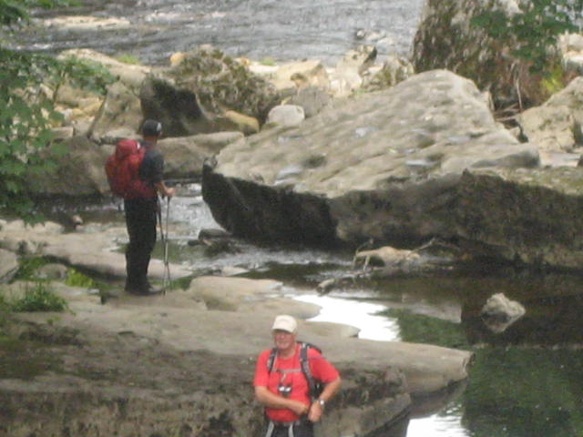
Leave the car park and head towards the Market Cross. Turn left and  . A finger post directs walkers to the Teesdale walk on the north bank of the river or to the south bank. We headed for the north bank and after passing a few houses crossed fields before walking through woodland on the river bank. Very pleasant walking on a sunny morning, leaves dappling the ground and the noise of the river which was pretty full and pouring through a gorge. After a couple of miles we came to Abbey Bridge and crossed to the south side. According to Pevsner the bridge is in Yorkshire so I have no details but has a beautiful arch, and traffic lights.
                                      Abbey Bridge
      The footpath on the south bank is just as pleasurable, above the river, easy to follow and easy on the feet. The path eventually becomes a minor road that brought us to Meeting of the Waters, where the River Greta joins the River Tees.
                                   The Tees at Abbey Bridge
                        The bridge over the Greta at Meeting of the Waters
                            River Greta, River Tees in the background.


                               Lovely Greta.
Having admired the whole area we moved on across fields past Rokeby Park and Mortham Tower before turning south and walking through fields and under the A66 road to Greta Bridge.
                                Mortham Tower
                                     and its Hemel
    We climbed the wall by the signpost for Brignall Mill (there are steps on the field side) and settled against the wall for a Herbie Spot. After Scotland we are back to sharing and today we had ginger biscuits (Ringtons), almond slices, caramel shortbread and scones from Mrs A. (Amazingly, several of us lost weight in Scotland in spite of the huge breakfasts. Perhaps we were missing Mrs A's scones and cakes)
  Lunch over we walked across the fields, although Dave and I did take a little time off to look at the ditches, all that remained of a Roman Fort.
Walking high above the river Greta we looked down on the Ruins of St. Mary's Church and graveyard and walked through fields of wheat (truly golden) before arriving at the tiny village of Brignall. It is a village, it has a church; St. Mary's.
                                                    Follow the signs
                              Ruined St.Mary's Church
                                       St. Mary's, Brignall.
In the village we spotted, eventually the marker that took us almost due north through fields of barley and oats to the A66. This east west highway is busy and it took some time and care to cross it. Once across we walked, still north, through a graveyard and downhill to the River Tees where we turned left, back on the path we had trod before., but this time heading west. At the Abbey Bridge we continued on the south bank the few hundred yards to Egglestone Abbey, a Premonstratensian foundation dating back to 1195. Never a rich foundation it was almost relegated to the status of priory. Knocked about a bit by Scottish and English armies it finally closed in 1548 at the Dissolution. Converted to a manor house for some time but now a ruin.

                                        Egglestone Abbey
Having admired this pile of stones we sheltered briefly under an ash tree as a shower struck before heading back, still on the south bank, through fields and a caravan park to Barnard Castle. We
crossed the river by a footbridge and walked uphill to the Market Cross and the car park.
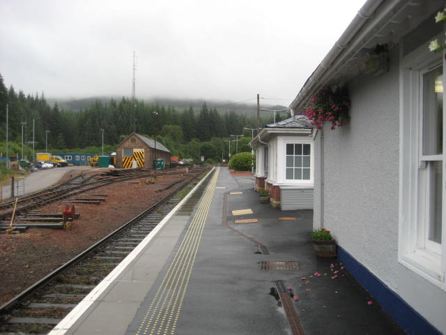
Changed we headed to the Morrit Hotel the few miles down the road at Greta Bridge They had Timothy Taylor's Landlord liquid heaven on draught.
This is a "good walk" as the Times might say, varied with little climbing but lots to look at and admire on a warm July day

The Matrix   MMXVI   SS
                                                                           steps                             miles
NAK                                                                30066                               10.43
Dave's LIDL3D                                               23533                               10.82
  "             USB                                                22300                                10.55
  "             NAK                                               22348                                10.48
etrex GPS                                                                                                   10.49
Brian                                                                                                          10.25
OUTDOOR GPS                                                                                        10.4

Walking time 3hr 18 mins         talking time      2 hr 11 mins

                Contains OS data copyright. Crown copyright and database right 2016
There is some overlap and I have a problem with my scanner

Gallery


Monday 25 July 2016

The West Highland Way.......July 2016

   It's "gentlemen's week" again, but this year, instead of renting a cottage or chalet, eight of us are going to walk the West Highland Way from Milngavie (pronounced Mulgie of course) to Fort William, a distance of 96 miles. Thanks to Brian we are organised having bought a package that books B and Bs and transports luggage from overnight stop to overnight stop. All we need to carry is the usual rucksack filled with sandwiches and waterproofs.
  The eight on the expedition are Brian, Ray, Dave, John H., Norman, John C., Paul and me. We drove in three cars to Milngavie and stayed the first night at West View, aka Best Foot Forward. The nearby Premier Inn kindly allows walkers to leave cars in the hotel car park for a contribution to charity, Great Ormond Street Hospital.
  It would be necessary to have several OS maps to cover the walk, we are using Harvey's West Highland Way map which cuts the stroll into eight sections on one sheet. The map is tough, waterproof polyethylene too, just in case it rains in Scotland. (Also avoids comments about laminating from sarcastic daughters). We also have several copies of  the Cicerone" West Highland Way" by Terry Marsh and  "West Highland Way" by Charlie Loran, both books full of hints and tips for the journey, points of interest etc..
You could get away without a map, the route is well posted with a thistle and occasional finger posts.

                                 Watch out for a sign!
Day 1, Milngavie to Drymen. A very wet day
  We left the official starting point about 9.30am. To begin with it was dry but after an hour it started to rain, and kept it up all day.
                                                             On your marks, get set, walk.
The first few miles of the walk are on old railway lines and paths through woods, lined with flowers at this time of year. We wandered off the official path to visit Mugdock Castle which had been used for centuries up to the second world war. A bit of a ruin, but it did have and Anderson Shelter! (WW2 air raid shelter).

                                             Mugdock Castle.
   Further along the way we passed Glengoyne Distillery but didn't bother stopping. The distillery appeared in an episode of Still Game and in the film The Angel's Share.
  We did stop at the Beech Tree café for a break but the rain encouraged us to keep going along roads to Drymen for our first night's rest.
We stayed at the Braeside B'n'B. The proprietors were most welcoming, obviously used to half a dozen drowned rats appearing mid afternoon. Dripping though we were we were given tea and biscuits in the dining room as one of the owners told us a hilarious tale about his mother getting confused between the words Lesbian and Vegetarian. "It was the ham that finally turned her, poor girl, she thought she should try everything."
We had dinner in the village pub, and retired to bed.
 Distance according to W H W book 12.5 miles
Distance by GPS                                 13.5
Total climb 1600 feet


                                                Braeside, Drymen.
Day 2, Drymen to Rowardennen.  A showery day
  Rejoining the WHW we walked through woodland and across moorland for seven miles to Balmaha. On the way we climbed Mount Connic (1184 feet) to enjoy the view over Loch Lomond.
                                            Loch Lomond from Connic Hill
                                             Connic Hill.  The bumps on the top are moraine

                                                A good solid path, it wasn't always like this
Connic Hill is a popular local walk and the summit was crowded with young folk and old. Like most of them we headed down to Balmaha on the shore of the loch and enjoyed tea and scones before moving along close to shore to the next evening stop at Rowardennen, a hotel, bar restaurant, just what a troop of gadgies wants.
Never having had a Scotch Pie I opted for one from the menu. I won't bother again.
After dinner a lady at the next table asked me where we were all from as she couldn't understand some of the things we said. I explained we were all from Tyneside and, apart from me and Norman spoke a strange form of our native language. She was Danish.

                      Rowardennen,known to us as Rhododendron.

Distance according to the book     15 miles
GPS                                                14.5                                  Running total(GPS)  28
Height climbed   3383 feet                                                                 ""                     4567 feet


Day 3  Rowardennen to Beinglas Farm. A few showers.
   The first seven miles of the day's walk, from Rowardennen to Inversnaid were on good paths alongside the loch, or even on the beach at times. Partly through woods with many streams feeding the loch. At Inversnaid we stopped for lunch.
                                                     Woodland paths
                                      It had been raining
                                        Inversnaid
                                         Calm before the storm
The second half of the walk was different to say the least. A rocky footpath close to the water, some scrambling and the ever-present tree roots carefully designed to trip walkers. This section was the hardest going of the whole walk but eventually we left the loch behind and crossed fields to Beinglas farm, next stop along the way.
Beinglas caters for campers, and there were many, caravans and people like us staying in chalets or "wigwams". A very friendly set up, hard working bar and restaurant staff and a photograph of Wet Wet Wet behind the bar. I remember the name but nothing they sang.

                                        Beinglas chalet, four rooms, we took the lot.
William and Dorothy Wordsworth stayed at Beinglas once.  She was not impressed, particularly with the food which was eggs. The place caused William to pen one of his lesser known couplets:
                           We reached Beinglas with aching legs,
                           All they had were hard boiled eggs.

After dinner we walked to the Drovers Inn, supposedly one of the oldest pubs in Scotland.  The pub was frequented by Rob Roy and I don't think it had been decorated since. At one time it was inhabited by a taxidermist who had kindly left his stuffed animals and birds for us all to admire.

                                            Drovers Inn, Beinglas.


Distance by the Book                13.5 miles
GPS                                            14                                       Running Total  42 miles
Height climbed                          2588 feet                                     ""                 7155 feet.
Day 4  Beinglas to Tyndrum   Another wet day.
Another walk of two halves, first across moorland and through woodland along some very muddy tracks to Crianlarich where we left the WHW trail and walked downhill to the railway station for tea and scones in the station café.
                                           Another good section


                                            Crianlarich station
Returning to the official path we walked through several miles of coniferous plantation before coming to the farm at Kirkton. Nearby are the few remains of St. Fillan's Priory. St Fillan was the son of St. Kentigerna and went round converting people and helping Robert the Bruce out at Bannockburn by having his relics displayed.
Further along we came to Lochan of the Lost Sword. Robert the Bruce, having lost this time at the battle of Dalrigh, threw his sword into the water in 1306. Touch of the King Arthur's to me.
Before we entered Tyndrum we passed an area which had been used for grinding lead ore. The ground remains poisoned and nothing grows.
In Tyndrum we stayed at the Dalkell Guest House, a rambling bungalow with slightly faulty door handles! Nice place all the same, interesting staff.

                                     St. Fillan's Priory


                                          Dalkell Guest House
Distance by the Book                      11 miles
GPS                                                  13.5                              Running total   55.5miles
Height climbed                              2533 feet                             ""                  9688 feet

Day 5   Tyndrum to Inveroran Hotel   A HOT DAY.
   We left Tyndrum, headed past the Green Welly shop which sold sandwiches for the day and hit the trail for Inveroran, a good track across moorland. At timews above the Fort William/ Glasgow railway line, at times below it, and always near the A82 road.
     By eleven we had made it to Bridge of Orchy, not much more than a hotel and bus stop but a great place for an early lunch.
The next section was along a rough track for about three miles to Loch Tulla and the Inveroran Hotel. So isolated there was no wifi!!!!!!! Well the hotel had a little but wouldn't share it. We sat outside the hotel, with a refreshing pint,watching other walkers come down the hill passing the lone rowan tree on the skyline. Some walkers expected to book in for the night but the hotel was full and the weary travellers had to phone for a taxi to take them on to some accommodation.
Inveroran is a very pretty place, great views of the Black Mount and the loch.
Distance according to the book                                       9 miles
GPS       10.9      miles                      running total        66.4 miles
Height climbed        1286 feet           running total       10974 feet


  Dorothy and William stayed here too, again they were not impressed with the food and didn't think much of the local drovers and shepherds sitting round drinking whiskey. William wrote;
                         "In Inveroran the folks are frisky
                           The food is poor but they like their whiskey.
Day 6  Inveroran to the Kingshouse Hotel   Donner und Blitzen.
  During the night it rained heavily with t6hunder and lightning thrown in for extra fun. It was still raining when we left Inveroran for the Kingshouse Hotel. However, after a few rumbles the rain stopped and we progressed at speed along a good hard track. This one was built by Thomas Telford in 1803 and had not been resurfaced since. It was a drove road across Rannoch Moor, that strange area of lochans and wild life, the largest area of the UK that is uninhabited. It is also the centre of our island's isostatic rebound I was told by the teams geologist. Apparently this means that after the ice retreated Rannoch Moor sprang back more than anywhere else. How do they measure it, that's what I want to know.
Regardless the scenery is impressive, the Black Mount when you leave Inveroran and  Buchaile Etive Mohr when you get to the head of Glen Coe. We arrived at Kingshouse as early as 12.30 after a 10 mile yomp. We arrived before our baggage! (Perhaps I should have mentioned earlier that cases were transported from  hotel to hotel by van, all we needed was a day sack.)
                                            The Black Mount

                                  Rannoch Moor
                                      Lochans, and little else. John Prebble wrote several books on the turbulent history of Scotland. In one of them, The Glencoe Massacre I think, I remember reading the account of some poor man who had to struggle over the moor in winter, and that was long before Telford was born.


                   The Kingshouse Hotel. Also visited by the Wordworths who, again, were not complimentary. Bet the Scots were glad when they wandered back to Grasmere and the daffodils.
  The staff were very helpful and although our rooms were not ready we were given the use of the lounge...............   and the bar. The bar sold Timothy Taylor's Landlord, one of the finest English beers, brewed in Keighley Yorkshire, the second best thing to come out of that town and its immediate surroundings. I offered a passing American  a sip, he was not impressed, probably preferred Coors or Budweiser.  Strange people, but I believe they do have an awful lot of micro breweries these days.
Distance by the book    10 miles
GPS                              10 miles                                   Running total   76.4 miles
Height climbed            1218 feet                                  Running total  12192 feet
We were told that the Kingshouse would close at the end of the season for a refurbishment.
Day 7 Kingshouse to Kinlochleven .                   The shortest day.
  Every place we stayed offered the " Full Scottish Breakfast", a splendid fry up of bacon, sausage, beans, mushrooms, hashbrowns, blackpudding, tomato and bread. The Kingshouse went two steps further with the climbers breakfast, all the above plus lodore sausage and something else. Dave tried it, successfully, most of us stuck to the FSB although somebody accidently asked for Full English and was promptly claymored.
Leaving the hotel we followed another good track, former military road by Wade or Caulfield, close to the A82, the road that goes down the magnificent Glen Coe. Early in the morning the mountains that line the glen were covered in mist.
                 "The Great Shepherd of Etive"  or Buchaile Etive Mohr.  (Confusing, Buchaile Etive Beag means the smaller Shepherd of Etive.
               As the road begins the descent of the glen the path turns north west and climbs "The Devil's Staircase"  Another military road, but a narrow path it climbs in zig zags until it reaches the highest point on the walk at 1789 feet above sea level. Like Connic Hill it is a popular walk followed by families including some quite small children. But most stop at the top, enjoy the views and then return.
              Looking north to the Mamores from the top of the staircase.
                                   and looking south.


                                     Human interest for Kathy and Sue!!!!!
                Darth Vader keeps midges at bay. We were seldom troubled by the terrible wee beasties.


From this point it seemed a long and steady descent to Kinlochleven. Across moor and then through woodland until we came to the small town which once had an aluminium smelter powered by hydro electricity. Now it has a power station and the national ice climbing centre, several pubs and a statue of an osprey.
We had dinner in the MacDonald Hotel, it was pushed for staff and short on the menu but the beer was OK
We stayed at Alt na Leven Guest House. The most luxurious B'nB I have ever had the pleasure to visit. The rooms were fresh, there was a welcoming box of fudge, an ipod dock, radio, TV and Willie, the genial host who told tales of mountain bikers, most of which are unprintable here!
And of course the breakfast was superb.


   Alt na Leven, B'n'B luxury.
                     If you have read the attempts of Dave and I to spot the Kielder Ospreys, you might understand my bitterness!
Distance by the Book   8 miles
GPS                               8.75                                                Running total 85.15 miles
Height climbed              1938 feet                                        Running total  14130 feet
Day 8, Kinlochleven to Fort William.. The Longest Day.
  As we left the hotel we spotted a bus going to Fort William. It was tempting. We walked out of Kinlochleven for a short distance before rejoining the WHW. The initial climb was on a rough track through woodland and seemed endless but eventually it joined another good track on another military road which we followed for about seven miles before coming to a fork in the trails and an information board. It was a good place to sit and eat lunch, admiring the views.


                             Ruined croft at Tigh na sleubhaich. It was here, five years ago, I first saw John's poncho. On a wet windfree day they are excellent.
              View at lunch time. Much of the forest has been cleared since we were last here.
  Lunch over we followed the right fork, a footpath, which went over moors and plantations before beginning the long descent into Glen Nevis.
   Ben Nevis appears. Britain's highest mountain at 4406 feet. (we're only a little country)

                                          Nearing the end.
The last couple of miles to the very end of the WHW are on the road which is a shame. The end point is at the very end of the high street which has lots of tourist shops and bars. Regardless we had made it and retired immediately to the nearest pub to celebrate. It happened to be a Wetherspoons but did not have the range of beers we expected. Didn't stop us though.
                              Paul John and me at the very end.
Distance in the book       15 miles
GPS                                16.35                                  Running total   101.5 miles
Height climbed              2838 feet                             Running total16968 feet.

         We stayed at Guisachan Guest House for the last night. Next day we caught the train (three of them) back to Milngavie, collected cars and drove home.


ALL MAPS:
Contain OS data copyright. Crown Copyright and database right 2016.
*********************************************************************************
  If you have read War and Peace (yes) you will know the very last chapter is a bit philosophical to say the least.
I think eight people is the optimum number for a trip like this. As we seldom walk all together as a single group it gives the opportunity for up to seven different conversations in a day. Most of us at some time walk alone. I don't mind this at all. It gives time to work on some of the great imponderables, like: If Black Holes have such strong gravity NOTHING can escape, how do you know they are there/ (Don't explain, I think I understand this one). And all those arguments you have with yourself which you always win.
On a more serious note we observed that most of the young people working in bars and hotels on the way were from Eastern Europe. And they worked hard. Where are the British students or young people on summer jobs?
We also noticed that most of the people on the walk were foreign; Americans, Canadians, Germans, French and Spanish. On the way we met the same groups every day, not surprising really. All were friendly. Favourites were a family of Americans, mum, dad and three daughters from North Carolina, Blue Grass musicians who were heading for a festival on Skye after the walk. We called them the Von Trapp Family. (Even more interesting, dad was a Newcastle United fan!)
 There was a German dad with his teenage son and daughter. The girl looked permanently fed up, probably wanted to be home with her ipod. And the 71 year old German lady with her daughter, we met hem every day.
But the star was the young German who, as we neared Fort William asked John and I he if could ask us a question.
Of course.
"How old are you?
72 and 66
RESPECT! he cried .
we did point out he was carrying full kit with a tent and things and we were having our stuff moved on. He reckoned he would walk like us when he was fifty. Hope he does.