Translate

Friday 26 December 2014

She's a big lass and a bonny lass...Dec25


It was Christmas Day in Ringwood Drive,
The happiest day of the year,
My mother and sister and daughter arrived,
And the garage was full of beer.
   I have had a lovely note from a lady in New Zealand who follows us gadgies around Northumberland as her great great grandfather lived in West Hedgely Cottages near Branton. I was also told that a lady in California was a regular reader too, perhaps she had family here.
No gadgie walk this week as it is the festive season but on Christmas Day, leaving the gadgette to slave in the kitchen, my sister who qualifies, and my elder daughter (www.cakepoppins.co.uk) who doesn't decided to have a short walk on and around Northumberlandia.
Northumberlandia claims to be the largest earth sculpture in the world. She was created from the spoil removed from a nearby surface mine and I seem to remember she contains 4.5 million tons of earth and rock and has about four miles of footpath to wander round. She represents the mythical goddess Northumberlandia and is a very large supine lady, lying coy and naked just outside Cramlington.
Having had a very light lunch and with the promise of Christmas dinner later in the day we drove the short distance, left the car in the nearly empty car park, wandered through the plantation that The Times  journalist sent to report on the sculpture called a forest and strolled round the lady herself. She is about half a kilometre long and has some splendid curves to contour round. From the top of her head their are vast panoramic views of Northumberland, from the sea in the east to the Cheviot Hills in the north. You can also see right into the pit next door where coal extraction continues and will for a couple of years.
We wandered round the perimeter, hoped that in a few years the pond would be full of rushes and water birds and took some photographs to send to Canada. Then we went home to dinner.
Happy Christmas to all my readers and for those in the Orthodox church it's not long until January 7th.

Looking down her nose. Yes they are. She's a big lass
                      No they are not, they are observation points


                                   Visions of a goddess
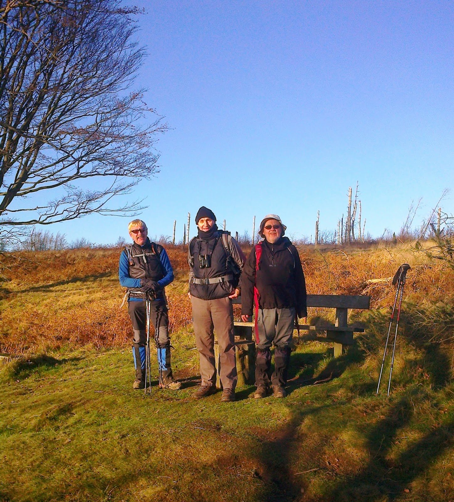
                                                     Me and my sister. She lives in Canada so 
                                                  is entitled to wear a reddish coat.
                                                  I was busy talking to someone


                                                              I took this with a clever Iphone App, Await future glorious
pictures from gadgieland

Friday 19 December 2014

Simonside from Tomlinsons......Dec19th
  The jolly jock on the local TV station forecast a bright but windy day with the possibility of showers late in the afternoon. As the days are about as short as they can be this time of year we opted for a slight variation of "Five go battling the duergers of Simonside July 5th 2013" so six gadgies set out in two cars to meet in the small Northumberland town of Rothbury (Hrotha's burg), at Tomlinsons Cafe and Bunkhouse on Bridge Street, an excellent cafe serving five star tea and five flitch bacon butties with a small salad to go with it. Friendly staff, crayons for the children (or gadgies) and a small library of books about the county.(www.tomlinsonsrothbury.co.uk)
                                                           Tomlinsons five star cafe and bunkhouse
                                                 Car park on south side of the river.
 Today's crew consists of John H, Brian, Ray, Ben, Dave and me and after breakfast in the cafe we  started the walk from the car park on the south side of the River Coquet.
A map would be useful, use OS OL42 Kielder Water and Forest. The car park is at NU057015 and it's free, a bonus.
 Leaving the car park we immediately crossed the river by the footbridge, and walked along a well made path on the north side of the Coquet. Just short of a mile a sign post directed us across fields to a minor road near Newtown. Turning right at the junction we came to the pretty little hamlet of Great Tosson (tot-stan, a look out stone) which has a ruined tower, several holiday cottages, some B and B establishments and a farm.
                                                Tosson tower
                    Looking across the Coquet Valley from just above Great Tosson. Ancient earthworks
                     in the centre of the picture, ditch and earth wall or rampart says Dave the archaeologist
 At the entrance to the farm we spotted a signpost and followed it through the yard and across a couple of fields before entering a plantation. We started on a good forest track but shortly came to a sign saying the footpath ahead is closed, sorry for the inconvenience. Being illiterate gadgies we ignored it and plodded up a very muddy path before sinking more than ankle deep in the mud of another track. A lot of the timber had been felled, the area could have been used as a set for a film about the trenches. Emerging from the plantation we were at the foot of the west end of Simonside, Bob Pyle's Studdie on the map. The footpath here climbs to the ridge of Simonside (Sigemund's (gel)set,  a seat or settlement.) The path is rocky, a bit of a scramble but emerges near the cairn on Simonside. It offers vast panoramic views across the Coquet Valley which is very wide and flat. Ben donned the tweed jacket and pointed out the meanders and future Ox bow lakes below us. We walked on to Old Stell Crag and called a Herbie Spot in a sheltered break in the rocks. At least it was out of the wind which was quite strong but fortunately at our backs for the whole of the walk along the Simonside Ridge.
Last walk before Christmas deserved a feast and the Great Gadgie Food Exchange provided the following for the food bank: McVities Melody Hobnobs, Ben's ginger biscuits, almond slices, mince pies and Mrs. A's ginger and apple cake, plus sandwiches,fruit and coffee. (still 13 stones or 182 pounds)
One good thing about the Simonside Ridge is that the footpath was so popular it suffered from erosion, a problem solved by raiding millyards in Lancashire and Yorkshire and laying a good solid path across most of the way.
                                             Brian snowboards on the only patch we saw.
                                                        It started to rain at lunchtime, some donned
                                                waterproofs to stop it.
                                A duergars Christmas tree near Dove Crag. It appears every year.
As we walked the last section of the ridge it began to snow heavily, earlier than the forecast but  from The Beacon the path goes downhill and we were soon out of the wind and driving snow, which stopped anyway. At the foot of the hill there is the Lordenshaw car park and signs pointing to the Cup and Ring Marks near Lordenshaw Hill Fort. The footpath here is on St. Oswald's Way and we followed it across moorland and fields to the tiny hamlet at Whitton. Just before Whitton we came across Sharp's Folly: Spelt Sharpe on the map)

                                                     The folly
From Whitton we followed the road back to the car park in Rothbury, changed and headed for The Anglers Arms at Weldon Bridge. They had Timothy Taylor's Landlord on offer and it being John's birthday the time honoured tradition of birthday boy buying beer was kept to.


     Both maps contain OS data (copyright)Crown Copyright and database right 2014

The Matrix
                                                                    steps                          miles
HiGear                                                        14543                        6.6
Pretty Pink                                                  19819                        9.3
Dave's 3D                                                    19036                       7.81
Dave's USB                                                 18621                        7.64
OUTDOOR GPS                                                                           7.9
Brian's GPS                                                                                    8.1
Ben's GPS                                                                                       8.11

Dave seems to have solved the pedometer problem
Gadgie Distance 424 miles
Boxing Day next week, everyone stays at home and plays Monopoly

Saturday 13 December 2014

SCEOPWAESCE  to NIEWEBIGINGA DEC 12th
Back on the road again after a few weeks off because of family commitments I rejoined the team for a gentle walk along the River Wansbeck, a name that possibly comes from Low German for a wagon brushwood causeway (waegn-spic) but this is not certain.
There are six gadgies out today, Brian, Dave, John H, Ben, welcome invitee Geordie Bob and me. The original plan was to catch a bus from Newcastle to Sheepwash (see title, and it means sheepwash) and walk along the river path to Newbiggin (see title and it means new building).
So we met on the Haymarket Bus Station for a change and caught the X22 to Guide Post (yes it means guide post).


                                      Haymarket bus station. A great improvement on the cattle pens that existed                                                when I arrived in Newcastle in 1964
We alighted (apparently Americans do not use this word, they "exit the bus")  from the vehicle at the big roundabout at Guide Post and pondered the route.
Should you want to follow this walk you need OS OL 325 Morpeth and the rounabout is at NZ253848.
We headed west along the A196 road and after about a mile, just past a very imposing 18th C farmhouse on the north side of the road followed the signpost that told us Bothal was 3/4 of a mile away. We walked alongside a field down a wooded lane where Dave spotted a nuthatch, along paths that were declared private yet seemed open to the public, across a narrow suspension footbridge that swayed pleasantly and came to Bothal Castle, a building going back to the fourteenth century. Near to it is St. Andrew's Church, dating back to the 14th century too.
                       Bothal Castle  and belted galloways(bottom right) enjoying the sun before becoming pies and things
Having admired the castle and the animals we walked roughly north through the tiny village and up the hill. By the first bend we found another Private Property WE Co Ltd sign by a gate and fortunately a public footpath sign next to it. We followed the sign through a short stretch of wood and then diagonally across two fields sprouting winter wheat. The footpaths go across the fields rather than round the edges. Ancient routes perhaps safeguarded by the might of English Heritage or someone. Having crossed two fields and skirted a pond we found the track that led downhill to the bridge at Sheepwash, easily recognised because it has traffic lights.
The entrance to Wansbeck Riverside Park is on the left, no need to cross the bridge. The next stretch of the walk follows the river bank for well over two miles and is very pleasant. Wooded at first then opening into a wide flat valley crossed by several road and rail bridges.
Not far into the park, near a childrens' play area and picnic spot we declared a Herbie Spot. Sandwiches, ginger biscuits, mini apple pies, Snickers bars, Galaxy Mistletoe Whispers and Mrs. A's boiled fruit cake.  Still 182 pounds though, or 13 stones as I prefer to say.
                                         Today's Herbie Spot
Along the river walk we spotted a robin, a heron, (making this a proper gadgie walk) a variety of ducks, cormorants and a kingfisher. A man taking wildlife photographs told us there were otters there too.
                                                         A Wansbeck Robin
                                      The river is surprisingly wide.......
                                       ....................and popular for walkers
                                             
As the river approached the sea the path became a track through sand dunes before entering and eventually leaving Sandy Bay Caravan Park. I had a good view of Blyth Harbour which always interests me as I worked in the town for nearly 30 years.


                                        These buildings once housed bauxite for the Lynemouth Smelter
                                           which has been closed for some years.
We walked along the sandy Newbiggin Bay; some way out there is a large statue of a couple, staring out to sea.
                                                  Newbiggin art work
                    And a miniature on the promenade.
                               St Bartholemews Church in Newbiggin. It is thought it may have been
                              originally a church connected with the Lindisfarne monks. Certainly dates
                                    back to the 13th century.
We headed for the Cresswell Arms which claims to be the last pub before Norway and seemed to be the only one open. A very friendly pub with a coal fire and chatty locals, we enjoyed some Bombardier Beer before catching a bus back home.
A relatively easy walk but very pleasant on a cold bright winter's day.

MATRIX    MMXIV  ZZ

                                                                       steps                           miles
Bad day for my peds
Higear, usually reliable                                     9916                       4.5
LIDL 3D                                                           15438                      6.97

Dave's   LIDL 3D                                              19606                     8.03
Dave's   USB                                                     19235                      7.82
OUTDOOR GPS                                                                              9.62
Brian's GPS                                                                                      10.5 (started early)
Ben's GPS                                                                                         9.2
Geordie Bob's GPS                                                                           9.31

And the bird of the blog goes naturally to the Kingfisher:

Saturday 6 December 2014

Reach for the pies..... December 5th 
For the third week running family commitments have prevented me from joining my fellow gadgies for the Friday walk/lunch/drink. And I am not happy about it as the walk included a visit to the famous pie shop in Great Ayton and it was a beautiful day for a winter walk, blue sky, crisp, cold, perfect.
GB has kindly sent me an account of the day. It is very similar to "Absolutely Topping Walk James Old Fruit" blogged on 19th of May 2012  which happens to be the second  most read of my blogs.
Even more infuriating is the meeting with The Times photographer as I'm the only one who subscribes to the Thunderer, have even sent them a couple of walks. (Unpublished of course; "Nicely written but our readers prefer blah blah blah.. ") Never mind
A Sign of the Times                
(aka The Pie walk)
Friday 5th December 2014

Today’s walk around Roseberry Topping and Captain Cook’s Monument in the North York Moors took place in cool temperatures but lovely winter sunshine.

There were 4 gadgies out today: Ray, Dave, John H and Brian.  Our first stop was in Great Ayton at the No 5 Coffee House. This excellent establishment provides friendly service, good quality products but you have to be there on a Saturday morning if you want a bacon sandwich – 1 point deducted.

We couldn’t go to Great Ayton without a visit to Petch’s butchers and their great range of pies. (hence the alternative title of this walk).  Dave availed himself of a large steak pie and Brian a smaller pork and red onion.


The walk started a short drive took us to the car park (NZ 570 129).  From the car park the route takes you east along a lane to the foot of Roseberry Topping followed by a very steep ascent, along good path, to the very summit of the hill.  The views are extensive particularly on such a clear day.  There were only 4 of us on top plus a chap with a substantial camera.  He worked for “The Times” newspaper and was doing a piece on winter walking and asked if he could take some pictures of us descending the hill.  Naturally being shy, retiring types we said yes.

The descent of Roseberry Toppping

The path then ascends steeply again onto Newton Moor.  We were heading generally in an east-north east direction towards Highcliffe Farm.


A tree with tinsel on Newton Moor

We had a short viewpoint detour onto Highcliff Nab before returning to the day’s Herbiespot on the edge of the woodland.  Brian had his pie and there was carrot cake from Dave, chocolate covered biscuit from John and Mrs A’s “walking fruitcake”. (Normally how she describes Brian). 


Ray, Dave and John post lunch
(human interest for Cathy from Goole)

At this spot Dave spotted a large flock of Bramblings (Fringilla montifringilla).  These Scandinavian visitors are very similar to Chaffinches but make next to no noise.  They land in a tree then seemingly just plummet to the ground.  They are very attractive, as was the Robin which was hanging around waiting to finish our crumbs.

Brambling

We now turned south west, past the track to Sleddale farm and meeting a road at NZ613 113, where we turned right. Soon afterwards there is an Iron Age Hut Circle with a dedication plaque to its excavator entitled Roland’s Close bit, I have to admit, I didn’t notice him.  The person in the photo is Dave.

A few more lumps

At the end of the road we turned left and followed the path down to the car park at Gribdale Gate which is the start of the ascent up to Captain Cook’s Monument.  There are fine panoramic views from this spot.


Captain Cook’s Monument


Gadgie explorers


Roseberry Topping from the monument

We returned to Gribdale Gate, climbed out of the valley and followed the escarpment back to Roseberry Topping which we avoided to the right and followed tracks back to the car park, arriving at 4:15.

                                                              The moon rises and Dave is packed

It is just a short drive to the King’s Head which provided us with a fine blonde beer.

Distance

Brian’s GPS            10.9 miles
Multimap               10.6
Daves Peds            10.6
Contains OS Data copyright. Crown copyright and data base right 2014.

The day after the walk, leaving my mother in my wife's tender care I went to watch Newcastle v Chelsea with Gadgie Dave. He couldn't stop telling me what a great day out it had been with the lads, how good the pies were, how good the weather was.......................