Translate

Friday 30 December 2011

A week off

for Christmas. No walk I'm afraid, but treat yourself to a view of our fantastic Christmas cake made by our daughter.
For more amazing cakes and fun reads go to
cakepoppins.blogspot.com
For non Russian readers it says "Happy Christmas to you"
From Santa Alex


Wednesday 21 December 2011

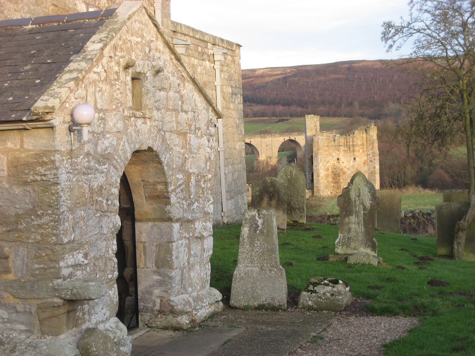
The Great Gadgie (Ou le Gadgei Grande)

walk.

It being almost Christmas there is no gadgie walk so to avoid helping with preparations for the holiday I am going to recall a walk we did some four years ago. We were all true gadgies, having bus passes although they were no use in France.
 
  In early September 2007 three of us, Ben aka halfmarathonmeister, Harry, aka routemeister and I ,aka the blogpiemeister, decided it would be fun to walk part of the cross European long distance walk known as the GR5. The section we chose was from Lake Geneva (Lac Leman) to Chamonix through the Haute Savoie, and this is how we did it.  We chose this time because advice told us that the mountain huts would be quiet, no need to book in advance,  we would complete the walk before the snow came, and more important, many of the huts closed at the end of the month.
  We packed as little as possible for what was planned as a ten day stay, but my rucsac weighed in at 11.3kg, a bit heavier than Ben's or Harry's, it's all the pork pies.
 Ben drove us from Newcastle to Edinburgh Airport, we checked in, searched in vain for a decent English breakfast, and, after coffee and croissants, boarded the plane for Geneva. As the plane took off Ben confided in us that he thought he had left the interior lights on in his car, as if.
 On our arrival we took a bus down town, found the railway station and bought train tickets for the journey round most of the lake to Saint Gingolph, a small lakeside town partly in France and partly in Switzerland. It was possible to walk from one country to the other across a small stream,  and without showing passports, spend Euros or Swiss Francs on either side. For small island dwellers like us, with no international borders, it is a strange thing to be able to do. Somewhere I have a photograph of my feet, one in Austria and one in Italy. I got the same silly thrill standing astride the Greenwich Meridian once, it's the child in all of us.

The train at Saint Gingolph, although Swiss it was not clockwork but it did arrive on time.


 A friendly man in the tourist office directed us towards a small lakeside hotel and we booked in, explored the village, ate an evening meal and went to bed.
  Walking day 1.
  After continental breakfast we found a small store, purchased supplies for lunch and armed with maps and an excellent guide book* set off to walk to Chamonix.
  One of the good points of walking this area, and also of the guide book, sign posts give times rather than distances, and so does the guide book. So having found the first of the route markers in Saint Gingolph, red and white horizontal bars painted on rocks or walls, we began the steady climb (1530m, almost a mile) to the Col de Bise. We reached the pretty village of Novel in an hour, less than the posted time, which was surprising as we kept looking back at the views of Lac Leman.


Looking back at Lac Leman (Lake Geneva) on our climb to Col de Bise.


We walked through forests and meadows, breathtaking views on all sides, past the Chalets de Neuteu and ever upwards until we finally reached the aptly named col itself. Col de Bise translates as Col of the NorthWind but it was not a cold one today, pleasantly warm, ideal for walking. After 45 minutes of walking we reached the Chalets de Bise and stopped for a beer and sandwich. As we enjoyed our snack a herd of goats appeared down the road, followed by a man who had a one legged stool strapped to his backside. Much to our delight, and that of the other people eating at the outdoor restaurant he proceeded to milk his goats.


On a one legged stool sits a lonely goatherd, yodel, yodel, yodel ee.


Although we had only walked ten miles we decided to stay in the chalet for the night instead of moving on to La Chapelle d'Abondance, the original first day target.
The chalet accomodation was basic, a French style toilet, a single cold shower and a bed that slept at least ten. Fortunately we were the only guests so we could spread out.     And we had a filling meal of pasta.


There could have been ten in the bed.


Walking day 2
   Next morning, after a simple breakfast and a cold wash, we set off again, climbing to the Pas de la Bosse, at a mere 1815m., and down to the pretty town of Chapelle d'Abondance. A pause for morning the and on our way, through the town, more beautiful meadows and on to La Torrens, a chalet, to the Col des Mattes, from where we got our first glimpse of Mont Blanc. Continuig through occasional boggy paths we reached our next nights meal and rest, the Col de Bassachaux. It was closed, something to do with a bank holiday. I would expect restaurants and hotels to be open on a bank holiday, but not today!  Harry, practical as ever, found a couple of tarpaulins we thought we could make into a simple tent, but at that moment two of the finest Frenchmen in the whole history of that country appeared. Amazingly both these men had worked for some time at Proctor and Gamble in Newcastle, and naturally they spoke English. They offered to take us down the valley in the direction of Chatel and  look for accomodation. Most gites, refuges and hotels were closed but eventually we found rooms in a hotel run by some Dutch people. We were too late for dinner but the chef, with apologies, rustled up one of the finest salads I have ever eaten, washed down with a couple of beers. And after the cold water of Bise we could luxuriate under a hot shower, sleep in single beds, with proper sheets ! The days walk had been about seventeen long miles.
 We had come about eight miles down the valley from our route and in the morning asked if there was a bus or taxi to take us back to Bassachaux. The young manageress said no, but if we didn't mind squeezing into the back of her van she would run us up there. Wonderful people. I have always liked the Dutch, their Amsterdam cafes have a certain air.
Walking day 3.
  Back at Bassachaux we rejoined the route, reaching via the Col de Chesery, the Refuge de Chesery in less than two hours. It had been open the previous evening, we could have stayed there had we pushed on.
 We had morning the at the refuge and took in the breathtaking scenery, walked round the Lac Vert, back into Switzerland to the Porte du Lac Vert. Here we were presented with spectacular views of the Dents du Midi, Grand Mont-Ruan and the Dents Blanche, the highest point being over 10000 feet, and snowcapped.

Just one of many spectacular views on the GR5 walk.


The next col was the Col de Coux, on the border. There is an ornithology station on the col, fine nets are used to trap migrating birds and insects, but only to study migration patterns, one bird had been caught seven times !  After a chat with locals and twitchers we pressed on to the Minesd'Or for the next nights rest. After dining on rabbit, salad and a delicious chocolate sweet, we slept well, it had been a fourteen mile day.
Walking day 4
After breakfast we bought the makings of a packed lunch, fresh rolls and local cheese and resumed our walk. It was a misty morning, but as predicted, a scorcher by lunchtime, as we progressed to the Col de la Golese, another ornithology centre. The next port of call was the village Les Allemands, named after a Germanic tribe routed by Clovis in the 5th century. This was the first time we had had a walk of any length on road rather than mountain track, it was not interesting! Neither was the small ski resort of Samoens, which with the exception of one cafe, seemed to be closed.

The Mines d'Or, a popular eating place and hotel.


A misty morning on leaving Mines d'Or.
I am nearer the camera, Harry is ahead.
Les vaches sont tres amuseant.


Back off the road and into woodland we past "Sixt -Fer- A -Cheval", six horse town to us  and ascended fixed ladders to get round a waterfall before we reached the next stop, Salvigny. An interesting auberge, my experience with school trips suggested it was used by parties of schoolchildren. We had a stroll round the small town, admiring the outbuildings which were built well away from houses and were heavily padlocked, a later bit of googling told us that they were store houses for grain, honey, brandy and even valuables, kept away from residences in case of fire. ( I hasten to add the googling was done back home, not on an iphone or anything).
Back at the auberge we joined about twenty others in the simply furnished dining room. The master of ceremonies served us with carrot and for the second course we were summoned, table by table, to the head of the room where Bernard doled out plates of a most delicious omelette. We were even allowed seconds, and ice cream. After a beer or two we slept well, 13 miles from Mines d'Or.
 Walking Day 5

  Next day we left Salvigny early. It was Sunday and we found many families out for a walk in the beautiful area around the waterfalls of Le Rouget, La Pleureuse and La Sauffaz.


Waterfall on route for Colletd d'Anterne.


As the number of walkers thinned out we climbed the Collet d'Anterne to 1900m and paused to admire the views. Centre piece itself was the white capped Mont Blanc. Soon we were at the Refuge Alfred Wallis (Chaletsd'Anterne) where we stopped for lunch before walking round the lake and climbing to the top of the Col, the views were even better. Soon we had descended a few hundred metres to the Chalet Refuge De Moede- Anterne, an attractive refuge with the standard large beds, aq very friendly warden, an excellent evening meal with a delightful wine to go with it and views to die for. We had walked 12 beautiful miles.


Mont Blanc appears out of the mist.


The Chalet Refuge De Moede-Anterne.


Walking Day 6
 The last day of the walk, and in some ways the hardest. A walk of two halves as they say. The first half was a steady downhill stroll to the Pont d'Arleve at a height of 1597m, followed by a tough rocky climb to the Col du Brevent at 2368 metres. But the effort was well worth it, directly below was Chamonix, directly ahead across the valley lay Mont Blanc, and yards in front of us a cable car. A sign on the path to Chamonix said it was closed because of a land slide so we invested 10 Euros on a trip down in the car. I enjoyed it, my wife would not have! (See Walking with a Gadgette)
 Mission  accomplished  we considered our options, stay in a Youth Hostel close by or go on to Geneva for a few days rest and culture before we flew home. We chose the latter and caught a coach back to the lakeside city, only to run into problems.
   The Geneva Youth Hostel was full. (Gadgies are allowed in Youth Hostels; in facy most English YHs are kept going by older people and primary school teachers with work sheets)  The UN was holding a conference in Geneva and accommodation was almost impossible to find, at least in our price range. Eventually we found a room at the At Home Hotel, but only fo0r one night and we had three nights before our flight. Nevertheless we took the offer, enjoyed a hot shower, relatively clean clothes and a meal in an Indian Restaurant. On the wall there was a large rectangle with moving pictures. Harry and I could not take our eyes off it, much to Ben's amusement.
 Next morning we went to the airport to see if we could change flights. Easyjet said we could go home at 10am, for an extra charge. We quickly decided to fly rather than spend time searching for a room. Anyway the extra cost was less than a hotel and another curry.
 Som home we went, arriving in Edinburgh at lunch time. Back in the carpark we loaded the car but as you may have guessed if you read carefully, it would not start. Ben had, indeed left the interior lights on! However, canny Scots know we English are prone to do foolish things and have a van that goes round the carparks giving the necessary juice! And at no charge! Brilliant!
We stopped on the way home at Morrisons Supermarket outside Berwick. Should you ever be in the area and hungry, I recommend the all day English breakfast. It doesn't quitem match the famous "Eight Item Breakfast" at Lerwick Coop, but that's another story.

 I am indebted to Ben for most of this. He is far more organised than me. I wrote a full, step by step account of the trip but, idiot that I am, did not make a hard copy or back it up. Ben kindly gave me his notes, we pooled photographs.
Without a doubt this was the best walk I have ever done, I would love to repeat it before I hang my boots up.
*Walking the French Alps; GR5 Lake Geneva to Nice.  byMartin Collins.
Published by Cicerone Books. They produce some excellent guides but we gadgies think we can live without the Northumberland Walks edition.
www.cicerone.co.uk

Sunday 18 December 2011

To the lighthouse....(or a walk with a Wetherspoons) December 16th


is a novel by Virginia Woolf. Virginia married Leonard Woolf, wrote some novels and had an affair with Vita Sackville-West. But they were members of the Bloomsbury group of intellectuals so that was alright. (Only To the Lighthouse, I don't think she wrote about Wetherspoons)

  This walk is a rural/urban/coastal stroll, ideal for a winter's day when daylight and time are limited. Six of us gadgies met at the routemeister's house in Killingworth (OS Explorer Map 316 GR 281716) A warm welcome was extended to Herbie, who has not been seen for several weeks, some of us exchanged Christmas cards and off we went, turning right out of the routemeister's front garden gate and following a path to Hillheads Garden Centre, egg and potao supplier.
  If you do this walk it would not be right to go through the routemeister's garden of course. Instead leave your car in Morrison's supermarket carpark, nip in for one of their excellent Jumbo Cornish Pasties, leave the carpark, turn right, walk past the primary school, straight across the roundabout and down the steps by the underpass and you are on the path.
 At Hillheads turn right on the dismantled railway line, now a country walk and  after about a mile, turn left on the road, cross the A19 dual carriageway and shortly afterwards turn right into Backworth, retired pit village and quite pretty. In the centre of the village bear left and cross a single track railway and walk to the next corner. Normally we turn right at the cattery and  cross fields to Earsdon *but there was a minor rebellion today, mainly by the punmeister, and we turned left, following a marked footpath towards Holywell.                                                                              Most gadgies like the John Wayne film The Searchers, indeed  an ideal night in has often been declared as The Searchers and The Vikings on DVD, accompanied by a few beers. I was explaining to Brian that a Cree  Native American I had once talked to in Canada told me that he did not understand the word "fortnight", he thought I was saying "four nights", as NA's often do in Westerns, along with "three moons" and naming their children after the first thing mother sees, like "Running Deer," ;the old jokes are the best.**
The punmeister explained that Canadians do not use the word fortnight, they prefer something stronger, a fortnight being two weak.
 Back to the walk; go through the village, passing The Olde Fat Ox on the right and the Milbourne Arms on the left, do not take the road to Earsdon but continue through a small housing estate. Turn left at the end and find in a corner of a cul de sac a small notice pointing towards Holywell Pond Nature Reserve. Take it. There is a hide in the reserve which not only allows you to watch the birds on the water but also makes a good Herbiespot. It being Christmas, mince pies were on offer as a change from the traditional pork pies.. There was little activity on the pond, moorhens, gulls, a few magpies on the edges, but little else. After lunch and one of the funniest jokes** I have heard for a long time we continued on our way, turning right at the end of the field  and after a while entering Holywell Dene.
 The Dene is a pleasant stroll in itself, good for finches, an occasional kingfisher and other small birds. I paused at the footbridge for a moment,some years ago myself and three others scattered a friends ashes at this spot, they will be far out at sea now.
  More trouble in the ranks: normally we walk the length of the dene into Seaton Sluice but today we walked out of the dene onto the B1325 and arrived at the Delaval Arms roundabout.
  Seaton Sluice is an interesting little village, the first sluice was built in the 17th century by Sir Ralph Delaval to make use of river and tide to scour the small harbour used for the loading of coal and salt. The harbour eventually proved inadequate and Sir John Hussey Delaval had a channel cut through the headland, installed locks and thus had a small wet dock 900feet (275m) long. Exports now included glassware, but a mining accident (see below) in 1862 put an end to coal shipments and some years after that the dock fell into disuse
 From the Delaval Arms the walk continues along the cliff top to St. Mary's Island, Lighthouse and Nature Reserve.


St. Mary's Lighthouse, cafe and birdwatching place.


 Continue along the promenade from the lighthouse.  It was a good day for bird spotting: redshanks, ringed plovers, oystercatchers, dunlins, curlews and lapwings.
Keep going across the links, past the white domed Spanish City and head into town. The old fire station is now a pub, one of the Wetherspoons chain, selling not only beer but also good food at relatively low prices. The vogelmeister and I opted for fish and chips and mushy peas for £3.99 ($6.20, $4.75 Euros and approximately 200 Roubles)
And beer at £2.30 a pint. Metro to Newcastle, bus home. A true gadgie walk of approximately 9.5 miles. Enough on a cold day with sleet and rain, and more interesting than it sounds.
* St. Alban's Church in Earsdon. A Chapel was built here in 1250, added too  and replaced in 1836 with the present building.  In the churchyard is a memorial to the victims of the 1862 Hester Pit disaster at nearby Hartley village. A cast iron arm on the pumping machine broke and crashed down the single shaft. The miners below ground were trapped and died of suffocation before any help arrived. In total 204 men and boys
were killed, some as young as ten years old. Following the accident, following lobbying from miners, the government passed legislation requiring all mines to have two shafts.  Hester pit was closed, although some years later another pit broke into the area, finding equipment just as it had been left in 1862.


The memorial to the victims of the Hester Pit Disaster in St. Alban's Church Earsdon.
Quite rightly local schools bring children here as part of their history studies.
The names and ages of all the victims are engraved on the memorial.


** Jokes will be sent upon receipt of a stamped addressed envelope and a donation to the Gadgie Benevolent Society. (Treasurer me)


Saturday 10 December 2011

Brian's Round - a walk in Lauder Country
December 9th

   Long ago the land north of the Humber was an Anglo - Saxon Kingdom. One of the Saxon Earls was blessed with identical twin sons, Egwulf and Eadwulf.  So excited was he that he forgot which of the two boys had actually been born first so when he grew old, knowing that his time was almost up he divided his land between the two boys, rather than have them fight over their inheritance. One son set up in what became Eglingham, a village we walked from two weeks ago (Jenny's Lantern) and the other built his home in Edlingham.  This division of land happened in other parts of Saxon England too. In Lancashire there are the villages of Yealand Redmayne and Yealand Conyers and in Somerset there are Midsomer Norton and Midsomer Murders. Everything was fine, the Saxon villagers of Edlingham began to build a church in the Saxon style: then, in 1066, the Normans came and spoiled everything, but they did add to the church which, after some repair and rebuilding still stands.
   Today's walk starts and finishes in Edlingham; it is called Brian's Round because  the punmeister found it on his ROM, whatever that is and said if it was a poor walk we could blame him.
  To get to Edlingham from Newcastle head north on the A1, turn off on the A697 at Morpeth and follow that road to the B6341, turn right, after a mile or so turn left down a minor road into the village. There is some parking near the church. The three local landmarks are clearly visible; the church, dating in part as far back as 1050, the ruined castle ,built about 1295 by Sir William Felton and the railway viaduct, about 1885, that linked Alnwick with Wooler and beyond. Using OS Explorer Map 332, the church is at GR114091.


The Church of St.  John the Baptist, the castle and the railway viaduct in Edlingham.


Leaving the church walk through the village past the Demesne* and at the finger post turn left and cross a field. Cross a second, diagonally and then a third. You are walking close to, or occasionally on a Roman road, the Devil's Causeway which branches off Dere Street north of Corbridge and goes to Berwick upon Tweed . Romans north of the wall, looking for the lost legion probably.* * Wearing his archaeologist's hat Dave reckoned the stones at the side of the field were probably the remains of the agar, the edge of the road.
 Cross a footbridge (not Roman) and walk up to the road. (B6341) Cross the road, through the gate and follow the path across moorland, or take the easier green path, to the edge of the coniferous forest. Take the track through the wood and emerge at Wellhope.
  There was a time when the family who live at Wellhope lived most of the year in a Teepee, clearly visible from the A697 as you drove to Wooler. I believe the head of the household was a stonemason and his wife taught jewellery at local evening classes. They seem to have moved into the cottage. The footpath from Wellhope  runs along a fence line and then through the wood until it emerges onto moorland. Head approximately South East for Snook Bank, taking the time if you wish to search for "cup and ring marks" on rocks.***

An example of Cup and Ring markings. Not the ones on this walk, but there are quite a few in Northumberland.


   Snook Bank was chosen as a Herbie Spot. Tucked behind a wall to shelter from the chilly breeze, and with a mouse for company, we ate lunch, including the now obligatory pork pies.
 The track from Snook Bank crosses a field and joins a lane which goes to Glantless Farm. Just before the farm take the path across fields to a minor road. Although it was a cold and dry day there had obviously been some heavy rain, the field was muddy. one of the rules for a Lauder walk. It sticks to your boots, slows you down and elicits much cursing, particularly in gateways. Cows have a habit of congregating at gates, churning up the ground so that all grass disappears and all that is left is mud. Walks could be a lot more pleasant without farm animals. However we saw two buzzards in the area, out looking for lunch.
  Turn left on the road and follow it through Shiel Dykes. Just beyond Shiel Dykes on the left is a small pond with platforms for fishing and a large scarecrow to frighten off passing Ospreys. And beyond this, on a south facing slope is a well ordered plantation, possibly raspberries, or even vines. Stay on the track for about a mile from Shiel Dykes before taking a path on the left that leads Phyllis's Plantation. The field consists of muddy ground and tussocks, another ingredient for a Lauder Walk. The path goes through the plantation but it is easier to walk round it and struggle upthe hill to Mare's Rigg. On the way up the slope we disturbed an owl, probably a barn owl.  Through the gate more tussocks and then heather, the final Lauder ingredient, hard work at times but heather cleans your boots. Down the hill to the road, turn right, after about a quarter mile turn left and soon you are back in Edlingham.
 Pedometers were not too well behaved today, the Higear opened at some point and when this happens it does not work properly. The Little Black Number fell off my belt but, having adopted the Dave Kear loop of thread safety system (LOTSS) I didn't lose it. The walk turned out to be about 9.5 miles, relatively easy going in spite of the Lauder conditions. Brian's Round proved to be a good winter walk, worth repeating.
 On the way home we were welcomed as regulars in the Anglers Arms at Weldon Bridge but I must admit to drinking only tea, my sexuality is now in doubt. But I was driving.


  Castle and viaduct in the evening light.


Five of the ancient monuments in Edlingham.  From the left: Ray, Harry, St. John's church, viaduct and castle.


Brian's Round (Below)


*By request: Demesne is that part of the land exclusively for the use of the lord of the manor. Not that he would go out planting his turnips of course, the peasants would have to do that for him.
** The IX legion. Marched off to Scotland and were never seen again.  The Eagle of the Ninth a children's novel by Rosemary Sutcliffe was filmed a few years ago as The Eagle
*** Cup and ring marks. Probably dating from Neolithic times and found not only in Northumberland but in other areas of Europe and also in Mexico. Nobody is sure of their exact purpose, religious, writing or art work?

  I have been a little worried about the lack of Russian readersthis week. They have probably been too busy, what with voting, counting and protesting, but there have been three hits this week.
Спасеба.


Saturday 3 December 2011

The Kielder Sanction 1 - the North Shore.
December 2nd
 
 Kielder water is the largest man made lake in Europe and around it is the largest man made forest. The North Tyne was dammed a little above the village of Falstone to create a reservoir to supply water to industry in the North East. Sadly there was a rapid decline in North Eastern industry and the lake is a tourist attraction with fishing, sailing, cycling and walking. A track has been built all the way round the lake; it is about 27 miles in length, well surfaced and about the right distance for a marathon. Two have been held so far. FTAs of my acquaintance say it is not a good marathon course because of the short ,twisting, steep slopes but it excellent for walking and riding I cycled it in summer, taking our time to enjoy the views it took about four hours.
 But today six gadgies are going to walk the north shore from Kielder Castle to Falstone, a linear walk but gadgie bus passes solve problems. There are  five  regulars plus a guest, "Geordie Bob", an exiled Tynesider and in law of the punmeister. Bob  worked for Swan Hunters* but when they closed he moved to Essex for work. We drove to Falstone and booted up. There is a nice little tea room which probably serves tasty bacon butties and tea but the shop does not open until 10.30 in winter and the bus to Kielder leaves at 10.35. Poor management. The bus is run by Snaiths and operates only on Tuesday, Friday and Saturday, so be careful if you fancy following in our footsteps. It is also advisable to ring Snaiths to check it is running. (01830 520 609).
The bus takes about 15 minutes to get to Kielder castle, another tea room and also closed at this time.
  You can easily do this walk without a map but the OS map I have is LR80 and Kielder castle is at GR632935. A more useful map is the one produced by Ashworth Maps called The Kielder Water and Forest Park map, available at visitor centres at the castle, Leaplish and Tower Knowe. You can also download it.
 The castle was built in 1775 as a hunting lodge for the Duke of Northumberland.
Head down the hill past the castle, pub on your right, maze on your left and when you get to the road make a decision. Either turn left over the Butteryhaugh bridge and join the northshore path almost immediately or take the forest path almost directly opposite and after about a quarter of a mile take the steep, railed footpath on your right onto Kielder viaduct. This old railway bridge, a relic of the North Tyne Railway, is of interest to lovers of railway architecture as the arches are not at right angles to the sides of the bridge but at an angle. The walls of the bridge have been decorated with wrought iron work; a train, a bee and others. Nice. Once across the viaduct you join the north shore path and keep on it to the dam. And go to the pub.
BUT. The path follows the lake shore quite closely, initially alongside the original reservoir, Bakethin. On your left is forest.
As a young man I drove a car from Albany in New York State to British Columbia. Once the excitement of being in America for the first time had subsided and we crossed into Canada we hit forest. For about three days, it got rather boring. Then we hit the prairies, for about three days, it got rather boring. Then we got
to the Rockies. I tell you this as a reminder that I have travelled, a bit.
  The Kielder forest can be dull too although the bird life can be interesting. After about two miles you come to the first of a series of art works that have been erected around the lake. This first one is called Silvas Capitalis, forest head or wooden top.


Punmeister Brian cheerfully picks somebody else's nose.


The routemeister keeps an eye on us. He says he was a good pupil.
  Of all the installations on the lakeside this is my favourite. It is beautifully made from wood, a staircase inside leads to the eyes and a space where Herbie could probably live for a few days.
  Moving on, the forest is on your left, but the bird life can be interesting. At a point there is another art work, called viewpoint, based on the Ordnance Survey symbol for viewpoint . It was designed by Tanya Katak, a Hungarian. Brian, a polyglot punster, explained that "Katak" is Hungarian for behind so that the lady would be known in English as "Tanya Behind". Think about it. The path wanders round an inlet, the Plashetts Burn, a photographs shows the Plashetts mine which once supplied the area with fuel and, by means of the North Tyne Railway, sent coals to Newcastle. Next stop, and one made use of as a Herbiespot is "Janus Chairs"
  At this point an RAF plane started making an appearance, flying low over the water and woods it crossed three times. I think it was a Hercules, practising a remake of "The Dambusters"


 The Janus Chairs.
  These huge steel chairs can be rotated, with some effort, so they can face out on the water or toward the forest, or anywhere between. Hence the name. On a fine day they make a comfortable eating place. On the opposite side of the lake is an Osprey nesting site, naturally they have gone to a warmer place for winter.
   The next stop on this cultural odyssey is Robins Hut. A wooden shepherd's bothy which looks across the water to Freya's Cabin. Robin and Freya were lovers, separated by the lake. Those of you old enough to remember "Running Bear" by Johnny Preston, a number 1 hit in February 1960 will be familiar with a similar tale. But Robin didn't drown.
 Continuing on the path, the forest is on your left. By the path is another work of art 
Salmon Scales. Twinkly and musical in the breeze.


Salmon Scales


  And then the Belvedere! Bright and shiny and a good shelter when the rain falls


This side of the Belvedere overlooks the water. Behind is the forest. There are seats inside and windows.


  On the next promontory there is a art work called 55/02 which I suspect is a Latitude/Longitude reference, slightly inaccurate, but we didn't go to this one. Nor, having rounded Belling Burn inlet did we go to the Wave Chamber,  but headed on to the carpark at the north end of the dam and down the old railway, now a footpath to Falstone and the cars. There were three deer feeding on the grassy bank of the dam, seen only by Dave and Ben who took a slightly different path.

 As this area of Northumberland is near the border with Scotland there are many tales of the Border Reivers but my favourite story is that of the Maid of Kielder, an event some years after the border squabbles had been solved.
  Towards the end of the eighteenth century a young maid of Kielder was due to be married but her farmer groom left her waiting at the church door. Full of bitterness the maid wandered the banks of the North Tyne, picking flowers. She either jumped or slipped, Ophelia like in to the cold river and drowned. Full of remorse her former lover fled the area and joined the army, serving in the Napoleonic Wars. When Boney had been dispatched to St. Helena, along with many other surviving soldiers, the farmer returned to the valley, only to be shunned by his neighbours who could not forgive him. He left again, this time for America. Many of the locals claim to have seen the maiden's ghost walk the banks of the Tyne. Now of course the river bed is at the bottom of the lake but some say that on occasion a ghostly light can be seen in the depths.
  For an after walk  drink we went to a pub in Bellingham, I think it was the Cheviot Hotel, anyway it was near Barclays Bank. A really friendly pub with some good beer, a strong draught cider and a selection of snacking nuts, kept in jars and sold by the tumbler. Hot and spicy.
 The pedometers worked well with some agreement. The walk is about 11.5 miles quite easy going.
Coming soon to a blog near you, The Kielder Sanction 2 - The South Shore
* Swan Hunters  a Tyneside shipyard. When I started working in Newcastle they were building huge tankers. They built HMS Ark Royal too an aircraft carrier. I was lucky enough to get on it before it sailed. It was big. Then I went on a Russian carrier used as a theme park in China. The Minsk was gigantic. Swan Hunters no longer builds ships or welds cars.